
Oregon Trail
July 27, 2000
Infection with Oregon Fever first struck when my younger sister Ruth decided she wanted to do the Oregon Trail. “Good idea,” I said, “maybe we can do it too. We can travel the entire Oregon Trail on our trip from Texas to the Heacock (my mother’s family) reunion in Oregon. We will spend about a month traveling slowly from Independence, MO to Oregon City, OR -- visiting most of the museums, roadside signs, and historical spots that relate to the Oregon Trail. And since we tow a 4-wheel, sport utility vehicle behind our motorhome, maybe we can even drive parts of the actual trail that is not maintained for automobiles. We will leave Independence about the same time that the emigrants started their trip, to get a feel for how much grass was available for livestock and to experience the storms on the plains, the heat of the desert, the dust of the trail and the chill of the mountains.”
“Great,” Ruth said. “But I don’t have an entire month that I can devote to the Oregon Trail.”
“Well, maybe you could meet us on the trail somewhere for a few days as you are driving to Oregon,” I suggested.
Later, Ruth decided to fly from Texas to the reunion in Oregon, so she was unable to travel with us. But because we had now “caught the bug,” we took her idea and decided to do the one-month, intensive tour of the Oregon Trail. As we began to plan the trip, Oregon Fever became more and more intense. Later, I came to realize that maybe my fever was similar to the fever experienced by the emigrants when they were deciding to take their covered wagons 2000 miles across the “Great American Desert” to the Willamette Valley of Oregon. Of course, their reasons for traveling to Oregon were much different from mine. I wanted to soak up some of the histories of the Oregon Trail – to get some sense of their experiences – their joys, triumphs, difficulties and tragedies.
But first, it seemed important to understand why these emigrants were so willing to risk their lives on such a long, hard and dangerous trip. There were probably as many reasons as emigrants – about 300,000 of them. But free land in the fertile Willamette Valley was certainly one of the primary considerations. Reports from French trappers, mountain men and missionaries indicated that the climate was mild and the soil was fertile. Some even exaggerated a little when they claimed that “folks never even get sick in Oregon,” or “pigs that run around in Oregon are already cooked and ready to eat.” But when Narcissa Whitman, a missionary’s wife, reported that they had made the trip to Oregon in a wagon, potential emigrants realized that it was not only possible to pull a wagon the entire 2000 miles, but that it was possible for women and children to make the trip. The Rockies could be crossed at the South Pass by the Wind River Range and the rivers could be forded. Now all the potential emigrant had to do was convince his wife that it was OK to sell the house and farm, buy a sturdy wagon and some oxen to pull it, obtain some supplies and head out for a 2000 mile hike. Maybe, in some of the male-dominant families -- where the father figure had been sufficiently infected with the “Oregon Fever” – he simply instructed the family to get ready. “We are going!”
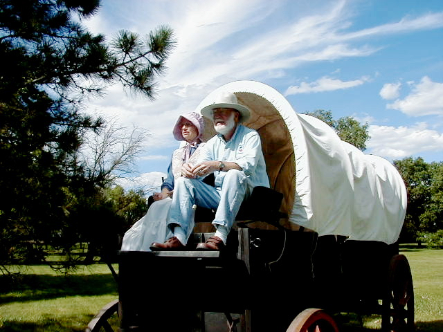 |
| Pat and Win Trail Simulation |
So the rewards were great – if they could make it – and it was “doable” but dangerous. One of the greatest fears of the emigrants was the threat of Indian attack. But stories of Indian attack were often exaggerated. Mostly the Indians only wished to trade something like a salmon for a shirt. Some Indians served as guides across dangerous river crossings. However, as the number of emigrants increased, especially with large, organized wagon trains, the Indians began to see a reduction in the abundance of wild animals along the trail. A few trigger-happy Indians, emigrants, and soldiers began to sour relations so that it became increasingly dangerous to travel alone on the trail. There were plenty of hazards to the emigrants. Their graves lined the trail all the way to Oregon. About one in ten humans died along the trail. Mortality of oxen must have been much higher. As often as not, the grave was dug directly in the trail so that it could not be detected by hungry wolves or Indians looking for a cheap scalp.
As they traveled, many emigrants kept diaries that provide fascinating reading. Also, there are a plethora of good books written on this subject, so there is no need for me to repeat all these stories.
Trail monuments dominated our trip. There are two kinds of these monuments: the natural landmarks that helped guide the emigrants as they navigated the trail and the artificial ones like historical signs and museums. The natural monuments can be very imposing – such as Chimney Rock and Scott’s Bluff in Western Nebraska or Independence Rock and Split Rock in Wyoming – then the Snake River in Idaho and the Blue Mountains, the Columbia River and Mt Hood in Oregon. Having read about these and many other landmarks, it was great fun seeing and recognizing them as we traveled the highways that more or less parallel the trail.
However, we invested much more time in the artificial monuments because they were such a great source of information. The newest is near Kearney, NE in central Nebraska, where its imposing structure is built like a large ranch gate over I-80. It is actually a little startling when first seen while driving I-80, partly because it is so unusual to see such a large museum built up and over an Interstate highway. Evidently, it was intentionally built this way so that it could not escape the attention of any driver, regardless of his/her state of driver’s fatigue. Named the “Great River Road Archway Monument,” it represents not only a great river road and trails (Oregon, Mormon, Pony Express and Gold Rush) but the transcontinental Lincoln Highway and its history. One might guess that it will become something of a major tourist attraction. It certainly did an amazing job of telling the story, from Indian trails to Oregon Trail to modern highway.
 |
| Win leading the bull |
On the roads following the Oregon Trail, there are several excellent museums that can be recommended. The National Frontier Trails Center in Independence, MO, Chimney Rock NHP (National Historic Park), the Fort Laramie NHP, Fort Bridger, WY, Fort Hall Replica in Pocatello, ID, The Oregon Trail Visitor’s Center in Baker City, OR (do not miss this one), The Whitman Mission NHS at Walla Walla, WA and the End of The Trail Center in Oregon City, OR are all worthy of an extended visit. Most all of the rest stops along highways near the Oregon Trail, especially in the State of Oregon, have excellent displays of Oregon Trail history. State Parks along the trail are frequently a good source of trail information.
As a tourist destination, Scott’s Bluff in Nebraska is certainly a favorite. From the visitor’s center, one has the option of driving up to the top of the bluff on a paved road through a couple of tunnels and up the steep mountainside. Or there is a paved trail to the top for the more adventurous. The view from the top revealed the rugged landscape along the south side of the Platte River that caused the emigrants to take the detour around Scott’s Bluff. Back to the east, it is possible to see Chimney Rock, where during a hike one morning, we heard and watched a family of Prairie Falcons. Three young fledglings were scattered on a nearby cliff and were loudly encouraging their parents to bring more food. Having seen Prairie Falcons only once before, we obtained excellent views of the “dirty armpits” used in part to recognize these beautiful and speedy birds.
Our trip was greatly enhanced by having obtained a copy of two books by Gregory Franzwa: “The Oregon Trail Revisited” and “Maps of the Oregon Trail.” Depending on our mood, Gregory sometimes gave us much more information than our tired brains could handle. But when we were fresh and eager, we could not get enough. He guided us over some dirt and rock portions of the trail that should only be attempted in a high-clearance, 4-wheel drive vehicle. We had some exciting moments when, 40 miles from nowhere, we were to forced stop and plan our route carefully over some really bad rocks. We survived OK but later learned that a group of Mormons, who were recreating their historic trip across the same rocks, had lost about 100 tires to the sharp rocks.
Being lost is not something that we will freely admit, but we once “became temporarily disoriented” when we guessed wrongly at an unmarked trail intersection. When our trail ended at a high embankment of either Beaver Creek or the Sweetwater River, we ended our “detour” and headed back to find the correct trail. Seeing a flock of rare Sage Grouse, which we added to our life list of birds, was one of the highlights of this particular day trip.
It is possible to drive the Oregon Trail in a few days, but if you are interested in the details and the drama of this great migration in human history, one could invest an entire summer or more following the many alternate routes. Although we spent a month on the trail, there were times when we felt the need to hurry so as not to miss the family reunion, consequently we missed some sights that we later regretted.
After the reunion, we found the Applegate Trail through California. Can there be such an affliction as Applegate fever?
No comments:
Post a Comment